Physical and financial systems are under growing pressure from a changing planet. Neural Earth fuses advanced geospatial intelligence and AI to turn complexity into clarity.
Platform
A unified ecosystem for geospatial intelligence.
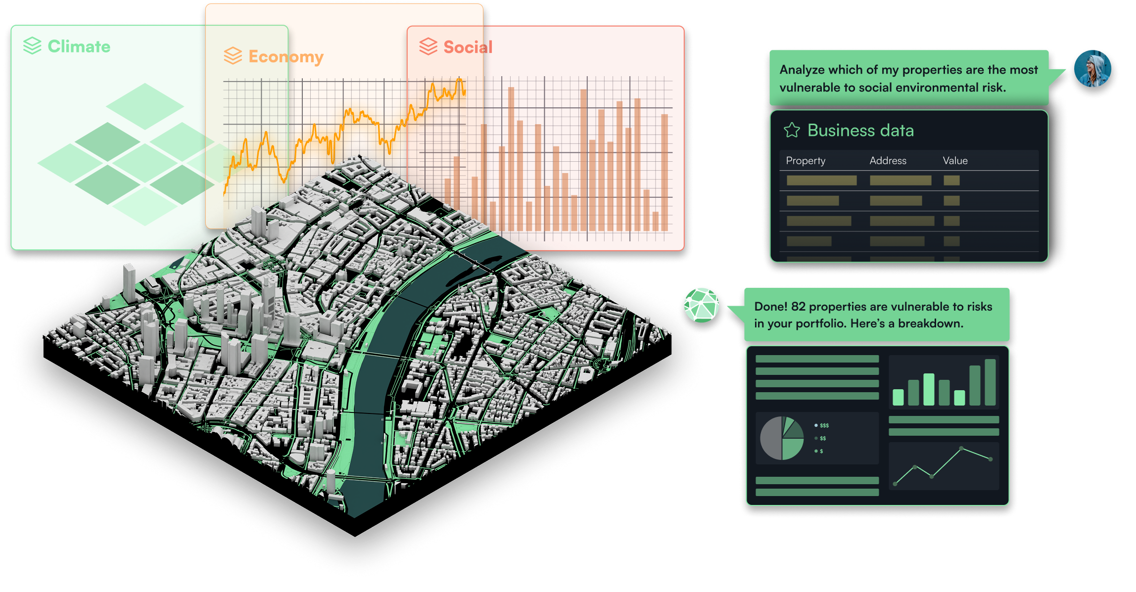
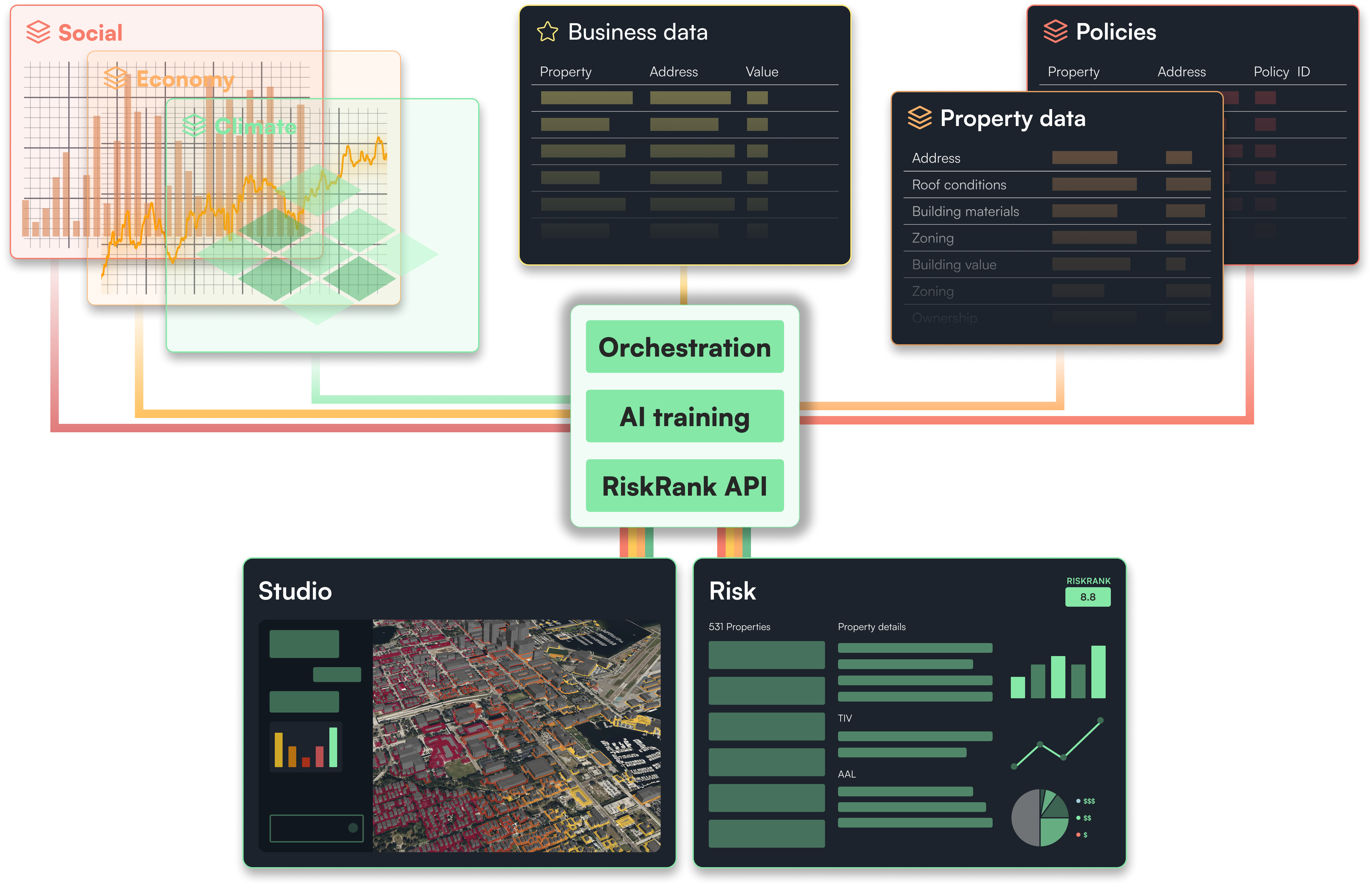
Neural Earth brings remote-sensing pipelines, hazard models, and feature extraction into a modern spatial analytical engine designed for scale.
Bring all your data into one flow in seconds. Unify models and move from data to decisions faster.
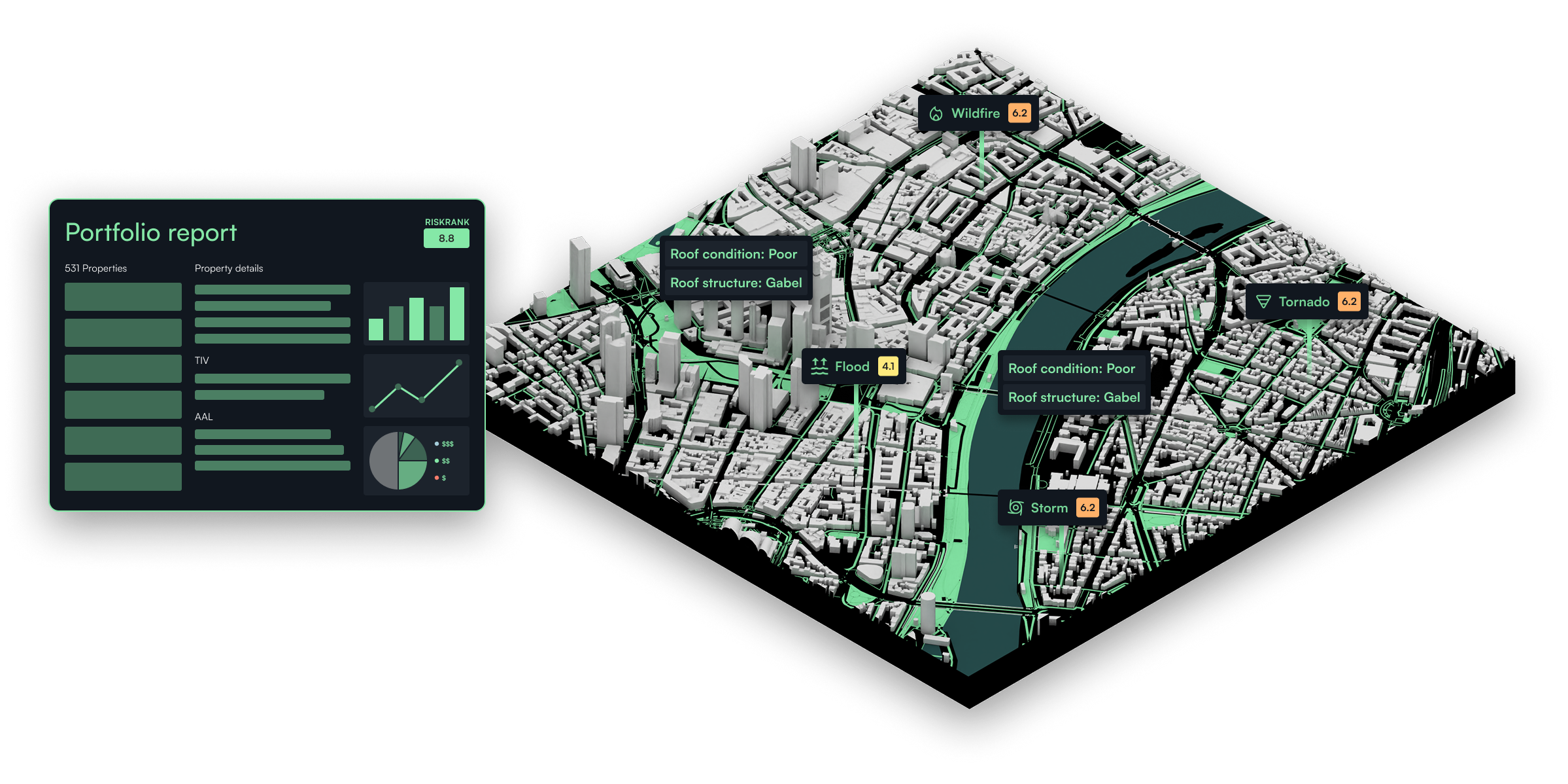
Finance & Insurance
Quantify your exposure with models grounded in real-world signals. Neural Earth fuses orbital imagery, infrastructure data, climate dynamics, and economic indicators to give underwriters and portfolio managers a dynamic view of risk, volatility, and expected losses across assets and markets.
Government & Defense
Strengthen situational awareness with unified, multi-domain intelligence. Neural Earth brings together SAR, optical, AIS, RF, weather, and ground data into a single operational picture so teams can detect anomalies faster, understand evolving threats, and plan missions with confidence.
Enterprise resource planning & Global operations
Optimize enterprise decisions with real-time spatial context. Neural Earth integrates geospatial reasoning into ERP systems to expose supply chain dependencies, infrastructure vulnerabilities, and on-the-ground constraints—enabling organizations to plan, route, and respond with precision.
Energy
Monitor critical energy systems with end-to-end operational visibility. Neural Earth applies remote sensing and physics-aware models to detect upstream activity, assess environmental impact, track infrastructure performance, and anticipate risks across the entire energy lifecycle.
Request a demo
Discover how AI-powered geospatial intelligence can transform property investment and risk assessment.
Request a demo
Discover how Neural Earth helps you deploy data, analyze assets, and assess risk using AI-powered geospatial intelligence.
Request early access to Risk
Be among the firsts to access AI-driven geospatial capabilities to analyze property-level risk and manage assets at scale.
Request early access to Studio
Be among the firsts to access AI-driven geospatial capabilities to explore markets and identify new opportunities.
Request early access to Neuron
Be among the firsts to access AI and geospatial infrastructure for data pipelines, models, and applications.
Request early access to Neural Earth
Be among the firsts to access Neural Earth and deploy data, explore markets, and manage risk using AI-powered geospatial intelligence.